


NORTH APOLLO Voting District, Armstrong County, Pennsylvania
About
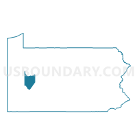
Outline

Summary
| Unique Area Identifier | 657028 |
| Name | NORTH APOLLO Voting District |
| County | Armstrong County |
| State | Pennsylvania |
| Area (square miles) | 0.60 |
| Land Area (square miles) | 0.54 |
| Water Area (square miles) | 0.06 |
| % of Land Area | 90.78 |
| % of Water Area | 9.22 |
| Latitude of the Internal Point | 40.59380760 |
| Longtitude of the Internal Point | -79.55661590 |
Maps


Graphs
Select a template below for downloading or customizing gragh for NORTH APOLLO Voting District, Armstrong County, Pennsylvania


Neighbors
Neighoring Voting District (by Name) Neighboring Voting District on the Map
- APOLLO WD 02, Armstrong County, PA
- EAST VANDERGRIFT Voting District, Westmoreland County, PA
- KISKIMINETAS TWP VTD ORCH.HILLS-NORTH, Armstrong County, PA
- OKLAHOMA Voting District, Westmoreland County, PA
- VANDERGRIFT WD 02, Westmoreland County, PA
Top 10 Neighboring County Subdivision (by Population) Neighboring County Subdivision on the Map
- Vandergrift borough, Westmoreland County, PA (5,205)
- Kiskiminetas township, Armstrong County, PA (4,800)
- Apollo borough, Armstrong County, PA (1,647)
- North Apollo borough, Armstrong County, PA (1,297)
- Oklahoma borough, Westmoreland County, PA (809)
- East Vandergrift borough, Westmoreland County, PA (674)
Top 10 Neighboring Place (by Population) Neighboring Place on the Map
- Vandergrift borough, PA (5,205)
- Orchard Hills CDP, PA (1,952)
- Apollo borough, PA (1,647)
- North Apollo borough, PA (1,297)
- Oklahoma borough, PA (809)
- East Vandergrift borough, PA (674)
Top 10 Neighboring Unified School District (by Population) Neighboring Unified School District on the Map
Top 10 Neighboring State Legislative District Lower Chamber (by Population) Neighboring State Legislative District Lower Chamber on the Map
Top 10 Neighboring State Legislative District Upper Chamber (by Population) Neighboring State Legislative District Upper Chamber on the Map
Top 10 Neighboring 111th Congressional District (by Population) Neighboring 111th Congressional District on the Map
Top 10 Neighboring Census Tract (by Population) Neighboring Census Tract on the Map
- Census Tract 8018, Westmoreland County, PA (6,550)
- Census Tract 9516, Armstrong County, PA (4,800)
- Census Tract 9515, Armstrong County, PA (2,944)
- Census Tract 8015, Westmoreland County, PA (2,568)
- Census Tract 8016, Westmoreland County, PA (1,412)